Mount Teide is dormant volcano on the island Tenerife, which is the largest of the seven Canary Islands. It lies off the northwest coast of Africa. It is currently inactive, the last eruption having ended in November 1909. Pico del Teide measures 3,718 meters and is the highest peak of the Kingdom of Spain and all the islands in the Atlantic Ocean. It is also the third largest volcano in the world (measuring about 7,500 meters from the base to the ocean floor). The altitude of Pico del Teide makes Tenerife tenth highest island in the world.
Teide began to form 170,000 years ago due to volcanic activity following a catastrophic landslide. The Teide base is located in the Las Cañadas crater (remains of an older, eroded, extinct volcano) at a height of 2,190 meters above sea level.
The volcano and its surroundings form Teide National Park, which covers an area of 18,900 hectares and was included in the UNESCO World Heritage List in 2007. (Wikipedia)
How to get to Pico del Teide
You actually have two options. You can simply take the cable car, which takes about 8 minutes and costs 23 EUR one way (link to buy a ticket here).
The second option is a bit longer, more demanding, requires strong will and physical fitness. There is also a hiking trail leading to Teide, which measures just over 9 kilometers, overcomes elevation gain of approximately 1,200 meters and the output takes about 3-5 hours in one direction. Down is of course a little easier.
Hiking to Pico del Teide
I chose this one of course. more complex option. Simply because I wanted to experience the journey, I wanted to know how difficult this route was. I wanted to try, What it's like to climb from 2,200 meters above sea level to 3,550 meters. I wanted to get to know the volcano up close, walk among the lava rocks, enjoy the views of the surroundings and just enjoy it.
Start of the route
The starting point of the entire route is Sednero de Montana Blanca, where is also small parking lot for about 8 cars. You can park here for free.
If there is no space here, another parking lot is about 900 meters towards the cable car, or a large parking lot by the cable car, but that is about 3 km away from the beginning of the route.
The route passes through challenging terrain, so I highly recommend sturdy trekking shoes, sunscreen, plenty of water and even a small snack. It will come in handy.
The first 5 kilometers
I would say the first kilometers of the route are relatively easy. Such walk. The first less than 5 kilometers It took us a while to get through. an hour and a half. Including a break and lots of photo taking of the surroundings and the growing volcano.
But once you pass the crossroads that leads to the top White Mountain, the real fun begins.
Perpendicular wall in sight
You have Montaña Blanca behind you and with ease with terror in the eyes you look at what's in front of you. With the next section all the fun ends and the real climb begins. From below it looks like an almost perpendicular wall and you say to yourself, no, that can't be, there's no path there... But yes, there is.
You are currently at an altitude of approximately 2,720 meters above sea level. There are another 1,000 vertical meters left to climb to the summit, on a little over 4 kilometers of trail.
Inhale, exhale
So let's go. The sun is shining, the air is barely moving, and you have no choice but to go. step by step further. You don't have to climb directly, but the path leads zigzag.
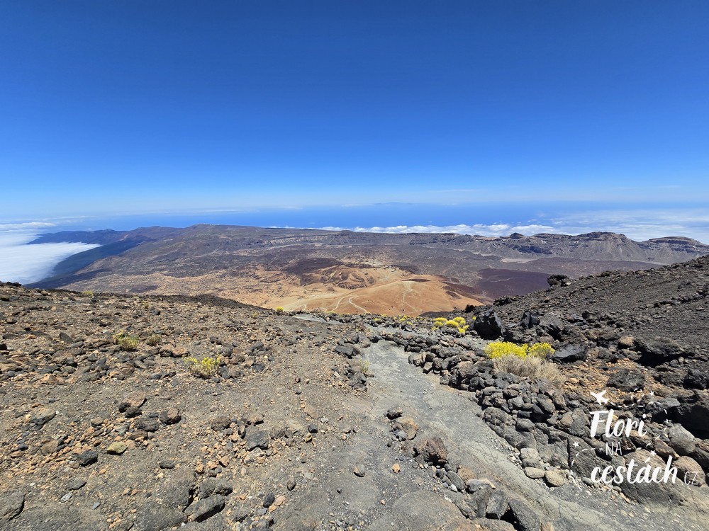
On every kilometer is the elevation around 240 meters. That's why you walk there and back again, the sun burns you from the left for a moment, from the right for a moment, and the altitude increases slowly. But even so, you feel every stone you climb, every step that appears on your way.
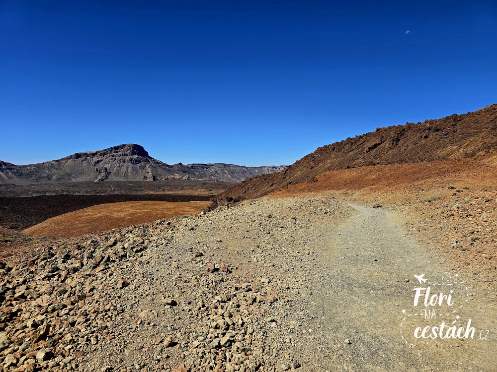
That route is infinite. End not and not come. Still just everywhere around lava rocks and between them one path. The one up. I admire how nature was able to create all this. Unbelievable. Although with each meter I can feel how hard it is to breathe, how each step starts to hurt, but it is still worth it. The one view, that size Teide, beauty.
A glimpse of civilization
Altavista Refuge is chalet, which you will find after 2.4 km of walking and 545 vertical meters from the Montaña Blanca crossroads. After booking in advance, you can stay overnight here and in the morning you can head to the summit of Teide (currently 7/2024, but the hut is closed with no known reopening date, link to booking here). You won't get refreshments here.
It would seem, however, that The peak of Teide is approaching. But the information signs will bring you back to reality. There are still more waiting for you another two kilometers. Which supposedly should take an hour. But looking at the blizzard in front of us, something told me that this wouldn't be quite the right estimate.
The last remnants of strength
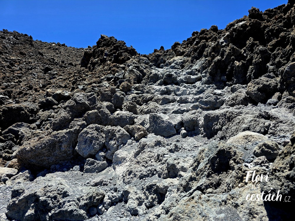
Suddenly the road stops meandering and it starts to go straight. But the more direct the path is, the steeper the final climb is. more demanding.
But here I am not giving up. I gather my last remaining strength, try to breathe regularly and deeply and only think that the worst is behind me, and that The end is near.. ...Not my end, as it might seem, but the end of the entire route, of course.
Mount Teide
With every meter I follow the position on the map and I'm counting down the last steps. of this rough but beautiful climb. After about 5 hours (yes, we stopped a lot, took pictures, flew with a drone) we are below the summit at an altitude of 3,550 meters above sea level.
To the very top you need extra permission, which are not many and reservations are made months in advance. I think, oh well. Oh well, there was no free spot when I wanted to make a reservation. They say it's not that difficult to get to the top, but that's what those who come up by cable car say.
However, view, which is on the right side and you can get to it practically straight ahead, is called Mirador La Fortaleza. You can sit here, breathe, gain strength and just look at the conical peak of Pico del Teide or on the other side at the caldera. Las Canadas a Teide National Park.
Here I was calmly telling myself that we had made it. That I had ticked off another item on my travel dream list.
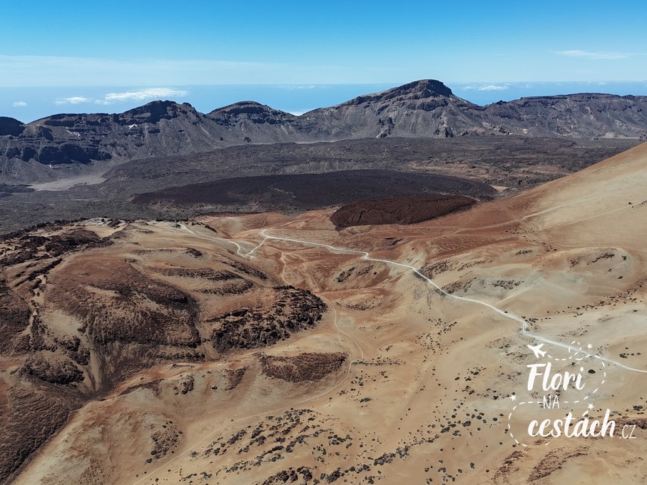
All that remains of the prospect is 550 meters straight ahead to the upper cable car station. Here you have the whole of Tenerife in the palm of your hand. On one side is the top of the volcano, on the other a view of the island.
Cable car tickets can be purchased online only, so we buy them here on our mobile phones and in a moment we are whizzing down. The whole cable car ride takes a really long time, probably 8 minutes.
From the parking lot we have to take the road to the place where we left in the morning. Unfortunately, it doesn't look like anyone is going that way and has room in the car, so we'll just do this. three kilometers to the car. That's like nothing.
And we are lucky that it is blooming right now Teide's thornbush, which I have never seen bloom before. It only occurs here and grows up to three meters. A beautiful plant.
Evaluation
I have to say that climbing Teide has been a dream of mine for a long time. It's certainly not an easy journey, and even though I exercise regularly and get a lot of exercise, I have to say that it was quite a challenge. Of course, that's just my opinion and it might not be that difficult for you. But I would still do it again sometime in the future. And next time, all the way to the top.